

Hike time: | 6 hours |
Start: | Mottel Naluns gondola station, above Scuol |
Finish: | Lavin station |
Season: | All Year, especially Winter |
Profile: | mostly between 1550m and 1650m, except initial descent from 2150m and final descent to 1420m |
Rating: | Downhill section to Ftan is steep and tiring, everything else is easy |
The lower Engadine valley is right in the far Eastern corner of Switzerland, a continuation of the valley leading Northeast from St Moritz. It is a Romansch-speaking area (so greet your fellow walkers with "Allegra" instead of "Grüezi"!), which is connected to the bulk of Eastern Switzerland by the 20km Vereina rail tunnel.
This walk consists of two sections, either of which can be done independently if so desired. The first stretch is a high traverse from the top of a gondola above Scuol, and a descent down to Ftan, giving panoramic views of the whole valley. The second, much gentler but longer stretch, follows the side of the valley Southwestwards back towards the rail tunnel, dropping down to Lavin. It passes through several small villages along the way, and the peace and tranquility of these places impresses as much as the architecture.
As well as being suitable for summer, this is also an ideal winter walk, as the paths are machine-packed higher up, and easily navigable throughout. An excellent escape from the hustle and bustle!
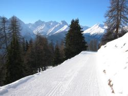 The immaculate trail from Motta Naluns 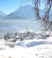 The path descending towards the village of Ftan 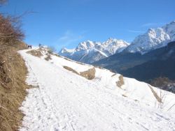 Looking back up the path with the valley panorama 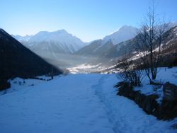 The end of the walk in sight, in hazy sunshine 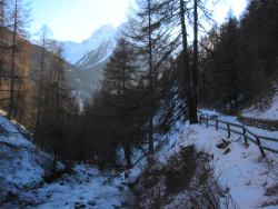 Winding through a side valley on the descent to Lavin |
The start of this walk is at Motta Naluns, reached by gondola from just next to Scuol main railway station. Scuol itself is served by regular trains through the Vereina tunnel from Klosters, and also from Pontresina. To avoid the first, higher section of this walk, just take a post bus from Scuol to Ftan, and join the walk there. The walk ends at Lavin, which has a rail station shortly before the Vereina tunnel (request stop only), although the walk can be made shorter by taking the train from Ardez or Guarda instead, also on this same line.
From Zurich, there are excellent connections to Scuol (less than 3 hours, with one change in Landquart), but it would be a rush to attempt this walk as a day trip. Instead, take advantage of the Engadine hospitality to make a weekend trip, perhaps with another walk (for example, the Val Sinestra one) on the other day. The return ticket to Scuol costs CHF 54 with halbtax, which is simpler and no more expensive than getting a return to Lavin and a single to Scuol. The gondola ride up to Motta Naluns is a rather expensive CHF 12 with halbtax.

For a zoomable, scrollable map of this hike, see this online map using Openstreetmap or Opencyclemap.
You can also download this kmz file scuol_valley.kmz to open it in programs like Google Earth or GpsPrune and then transfer the track to your GPS.
Motta Naluns - Ftan - Ardez - Bos-Cha - Guarda - Lavin
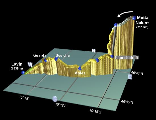 |
As mentioned above, this hike splits neatly into two sections, each of which can be done separately, if desired.
From the upper gondola station, turn left to leave the crowds of skiers behind, and follow the broad, immaculately-groomed trail heading Westwards along the side of the valley. This path, more like a manicured road, leads high above the valley floor, with not a sound to disturb the spectacular scenery.
After around half an hour, with some descent, you rejoin the ski area and cross the Prui drag lift and piste. Cross carefully, and continue on the path, rising up to the top of the Ftan chairlift after another 10 minutes or so. For those not wishing to descend on foot, this chairlift can whisk you down to rejoin the walk for the following section.
The footpath down to Ftan is signposted, descending sharply and briefly joining a sledge run before looping back towards Ftan. The bottom of the chairlift is reached in around 50 minutes, knees permitting! From the chairlift it is a mere 5 minutes stroll down to the village, and the post bus stop.
From Ftan, there are two main signposted footpaths to Ardez, we will take the higher route, labelled as 1 ¾ hours. This leads upwards from the post bus stop, climbing a road out of the village, before branching along a flatter footpath. After around 40 minutes, you reach a signpost where the path meets a pair of cross-country (langlaufen) trails. Take the left-most of these two ski trails, across the plateau, until they rejoin. When the ski trails once again split, take the right-hand one up to a footpath signpost, leading into the trees. In this shaded section, take care on the icy patches - they can be substantial, but easily avoided. Back in the sunshine, continue the traverse and follow the contours around a narrow, heavily wooded side valley. After around an hour from the signpost, you drop down above the village of Ardez, with its cluster of buildings and tiny ski pull. Those wishing to take the train from Ardez should follow the signposts down into the village from here.
Rising up away from Ardez again, the broad path passes numerous idyllic picnic spots, before arriving in Bos-Cha after around 40 minutes. Here are signposts to Guarda rail station, but we do not wish to descend to the railway line just yet - look for the right turn signposted for Guarda bus stop (PTT), leading between the buildings and back out on a broad, sweeping path. You should reach the picturesque village of Guarda in around 20 minutes.
Wander through the attractive village, with its tangle of narrow streets and painted buildings, and pass the post bus stop. Following
the signs to Lavin, leave Guarda and join a narrow footpath descending in switchbacks to meet a road. After crossing a bridge over a
side-valley, the road drops gently down towards Lavin, bringing you eventually within earshot of the highway at around 1500m. It is then
just a short walk down, crossing underneath both road and rail bridges and following the signs to "Staziun", to reach Lavin station
after around an hour from Guarda.
The following are the coordinates for waypoints along this route, obtained from GPS. They can be used either in another GPS, or along with a map, to provide additional references if necessary.
                           Latitude       Longitude    Altitude(m)
        Motta Naluns      N 46°48'38.3    E010°16'17.6    2146
        Chairlift top     N 46°48'21.5    E010°14'51.8    2062
        Ftan chairlift    N 46°47'41.1    E010°14'45.3    1670
        Signpost          N 46°47'15.0    E010°13'36.9    1638
        Signpost Ardez    N 46°46'43.5    E010°12'14.9    1548
        Bos-Cha           N 46°46'37.7    E010°10'05.1    1664
        Guarda post bus   N 46°46'31.7    E010°09'04.6    1641
        Lavin Station     N 46°46'10.7    E010°06'40.2    1432
The official site scuol.ch has a host of information on the town of Scuol and the surrounding area. For skiing or snowboarding here, see Snowboarding in Scuol.