
This section of the website, obviously still in its very early stages, will cover day hikes in Germany. For hikes in nearby Switzerland, see the Swiss hiking section.
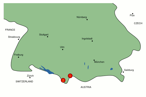
Here's a map of southern Germany showing (roughly) where the hikes are. The map currently only covers the south of the country because this is where the interesting Alps are - and where the majority of the covered hikes will be located. As you can see, there are currently just two hikes available, both in the Allgäu alps.

| Name | When | Summary | ||||
1
|
Iseler | Summer | Tricky hike up to the peak of Iseler, along the border ridgetop and a long descent back to the base station. |
|||
2
|
Fellhorn | Summer | A short, medium difficulty hike along the ridgetop of the Fellhorn and back to the middle station. |
Please note that all times and prices are approximate, and may be subject to change since the hikes were researched. Particularly in Winter, the difficulty of a hike depends greatly on the current snow conditions, and can change from week to week. Use common sense and backtrack or shortcut if necessary.
The ![]() icon means that a GPS was used to record the hike, and so waypoints
and 3d plots are available. The
icon means that a GPS was used to record the hike, and so waypoints
and 3d plots are available. The ![]() icon means that photos are
available. For certain hikes there are also Kmz files provided, which you can open in Google Earth or GpsPrune to show the routes - these are indicated by the
icon means that photos are
available. For certain hikes there are also Kmz files provided, which you can open in Google Earth or GpsPrune to show the routes - these are indicated by the ![]() icon.
icon.
Also, please feel free to share your experiences. Any additional information, corrections, suggestions and comments would be gratefully received by email - all due credit will be given.
If you found any of that useful, you may also be interested in trying some Snowboarding in Germany as well.