

 |
The sixth stage of the Alpine Pass Route starts from Meiringen and after a long day climbing over the Grosse Scheidegg (large watershed), arrives in Grindelwald in the heart of the Berner Oberland. It is the first of two Scheideggs on this route, and can easily be combined with the following one to Lauterbrunnen, as a weekend trip.
It involves a fair amount of climbing (almost 1400m), but it is gradual and not tricky. If you want to shorten this, you can easily take a bus from Meiringen as far as you like before starting the walk. You could also do some of this climbing on the previous day, as that was relatively short, and overnight somewhere along the way instead of Meiringen.
Note that although this pass is crossed by a road, it is closed to private traffic, so there isn't the same hectic motorbike drone as the Klausenpass - just occasional buses and bicycles when the footpath does follow the road. The scenery builds dramatically up to the pass itself, with the impressive Wetterhorn forming the main focus. From the Grosse Scheidegg itself, the views down to Grindelwald, the Eiger, and the Männlichen ridge are superb.
Meiringen has many transport connections, including the Brünig pass over to Luzern, or along the Brienzersee to Interlaken. There are also several postbus lines serving the surrounding area. Grindelwald is tucked away at the end of a private rail line from Interlaken, taking around half an hour for the scenic trip. The whole of this day's route over the Grosse Scheidegg is covered by a bus route until late October, making it very easy to shorten the walking.
From Zürich, the trip to Meiringen takes around 2h20 and CHF19 (via Luzern and Brünig pass), and the trip back from Grindelwald takes about 3h10 and CHF36 (via Interlaken and Bern). This would be an extremely long day trip though - better to stay overnight and take on the following stage afterwards.
For Meiringen, Hasliberg and other places in this area, there are lists of hotels at alpenregion.ch. For Grindelwald, see grindelwald.com for a wide variety of accommodation.
Grindelwald youth hostel (youthhostel.ch) sits high above town on Terrassenweg, and offers 6-bed dorms with warm bedding for CHF38 (non-member price). It's a friendly enough place with great Eiger views but lacks a comfortable lounge area.
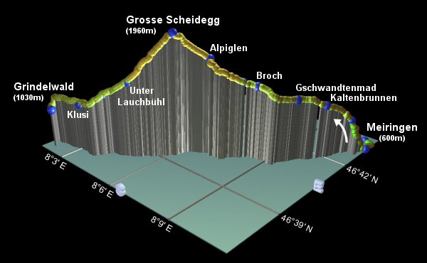
Meiringen - Kaltenbrunnen - Gschwandtenmad - Grosse Scheidegg - Unter Lauchbühl - Grindelwald
Hike time: | 6.5 to 7 hours |
Approx dist: | 23 km |
Start: | Meiringen station |
Finish: | Grindelwald station |
Profile: | from 600m up to 1960m, then down to 1030m |
Rating: | easy |
From Meiringen station, follow the signposts towards Rosenlaui and Grosse Scheidegg, out to the main street of Meiringen
and along it past the Sherlock Holmes paraphernalia. Continue along this main road, curving round to the right as it leaves the
small town, past the turnoff to the Aareschlucht. Shortly you reach a signpost at Willigen, leading you rightwards up a
narrow road between the houses. A stony track shortcuts this road as it winds uphill, allowing you to race the cyclists, should
you wish. The restaurant at Schwendi is reached in around 45 minutes from Meiringen.

Stone track climbing away from Meiringen
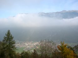
Morning fog gradually disappearing over Meiringen
It's not uncommon for Autumn fog to cover Meiringen in the morning, so climbing up through Schwendi can bring a sudden improvement in the sunshine and blue skies.
Continue uphill for around half an hour on a well-signposted route up roads and steep tracks, to reach Zwirgi.
The signposting is still excellent, always pointing towards Grosse Scheidegg, so it's impossible to go wrong.
Another half-hour or so brings you to out of the trees and gives you a sudden, breathtaking view of the enormous
snowy peaks ahead. A short distance further up the road is Kaltenbrunnen, with a restaurant and accommodation.
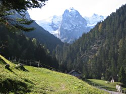
The first, breathtaking views of the peaks ahead
From Kaltenbrunnen, continue up the road and take the path through the trees. Shortly you emerge on a flat
path alongside the stream, and are confronted by a sudden reappearance of the now much closer peaks
directly ahead, with a tumbling glacier hanging over to the left. Gschwandtenmad is just a short flat walk
away, around 30 minutes from Kaltenbrunnen.
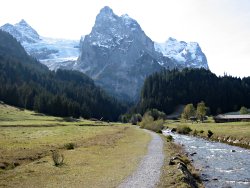
The Wetterhorn on the way to the pass
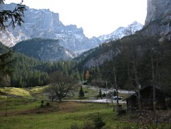
Towering peaks above Rosenlaui
Another 15 minutes or so brings you to Rosenlaui, with a hotel, cafe and even its own Gletscherschlucht. Here the path bends sharply round to the left, making you think you're heading steeply up to the ominous peaks above, but this is just a trick because it quickly bends round to the right again to head gently uphill.
Carry on upstream to Broch, where there's a superb barbecue area just after the signpost. Swiss organisation has provided the barbecue, benches, tables, wood and even newspaper (they think of everything here!) From here you get your first view of the pass, overseen by the shady Wetterhorn.
At the Schwarzwaldalp signpost, just before the hotel/restaurant, the path diverts left and begins to
climb more steeply, dotted with red and white markings. Crossing the now open, grassy slopes, the views
back towards Meiringen get larger and larger, stretching all the way to Hasliberg and beyond.
Emerging once more on the road, cut across and up to the bus stop at Alpiglen (not to be confused with the
other Alpiglen which we'll pass in the next stage), after around 1h30 from Rosenlaui.

Looking ahead to the Wetterhorn and the Grosse Scheidegg
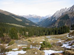
View back towards Meiringen
Continuing uphill (on the final push now), the path heads more or less directly for the summit,
reaching the hotel/restaurant after another 40-50 minutes. There's an interesting mix of people at the
top, with a broad range of walkers, cyclists and bus trippers, all enjoying the view.
And the views from the summit are quite spectacular,
and plentiful reward for the climb. The Wetterhorn is of course looming over from the left, the valley
back towards Meiringen/Hasliberg is still all visible, and then suddenly over the pass you get a full
panorama of the famous Jungfrau region, including the Eiger above Kleine Scheidegg, the Männlichen
ridge, and the Faulhorn over to the right. This is classic Berner Oberland.
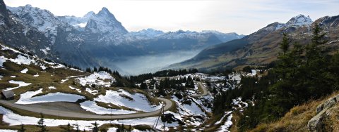
View down to Grindelwald from Grosse Scheidegg, with the Eiger middle-left
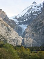
The upper Grindelwald glacier
The leftward Grindelwald route is signposted for the Hotel Wetterhorn, and drops down on a tangle of eroded paths, joining and rejoining the road on the way down. At Unter Lauchbühl, after around 50 minutes, take the poorly-indicated track between the buildings, which continues to drop steadily down towards Grindelwald.
At the signpost intriguingly named "7. Schürli", there are two ways down to Grindelwald, and it doesn't make a lot of difference which one you choose. If you're staying at the HI Hostel or the Naturfreundehaus hostel, you should head rightwards for the Terrassenweg.
There are great views of the Obere Grindelwaldgletscher oozing down to the right of the Wetterhorn, as you reach Moos (clearly named after the cows who live here). You can also clearly make out a perilous-looking footpath angling up toward the glacier from the left, and the even more perilous-looking hut perched up on the cliffside.
Continue past the Untere glacier, and on towards Grindelwald. If you're following the signs for the Terrassenweg, you'll reach Klusi in around an hour from Unter Lauchbühl, and the hostels another half-hour from there. The station is a mere 15 minutes downhill from there (more coming back uphill!) or if you're going straight to the station you'd obviously cut the corner off, following the many signposts.
The next stage in the Alpine Pass Route is over the Kleine Scheidegg
to Wengen and Lauterbrunnen.
The following are the coordinates for waypoints along this route, obtained from GPS. They can be used either in another GPS, or along with a map, to provide additional references if necessary.
                           Latitude       Longitude    Altitude(m)
       Meiringen Station  N 46°43'39.3    E008°11'03.4     595
       Willigen           N 46°43'06.4    E008°11'28.6     615
       Schwendi           N 46°42'49.3    E008°11'13.0     792
       Zwirgi             N 46°42'44.6    E008°10'57.1     980
       Kaltenbrunnen      N 46°41'57.9    E008°10'24.8    1210
       Gschwandtenmad     N 46°41'17.9    E008°09'42.4    1300
       Rosenlaui          N 46°40'48.8    E008°09'13.7    1328
       Broch              N 46°40'41.3    E008°08'31.5    1428
       Schwarzwaldalp     N 46°40'30.3    E008°08'02.9    1456
       Alpiglen           N 46°40'03.4    E008°06'57.6    1683
       Grosse Scheidegg   N 46°39'20.6    E008°06'06.5    1962
       Unter Lauchbühl    N 46°38'32.2    E008°04'53.4    1448
       Moos               N 46°38'09.6    E008°04'00.8    1279
       Klusi              N 46°37'51.2    E008°03'09.3    1140
       Hostel             N 46°37'44.6    E008°01'37.9    1114
       Grindelwald Stn    N 46°37'27.2    E008°02'02.6    1034
grindelwald.com has all the Grindelwald stuff, and the bus service is described at grindelwaldbus.ch. A good overview drawing of the Grindelwald area is at jungfraubahn.ch under English-> Jungfrau Region-> Maps.
An alternative end to the walk, detouring from Grosse Scheidegg round to First, is described by walkingswitzerland.com. From First you can descend to Grindelwald in the gondola, with a rented trottibike or mountain bike, or on foot.
For other activities in the area, there's a shorter walk from Reuti to Brünigpass, or there's snowboarding at Hasliberg and Grindelwald First.