

 |
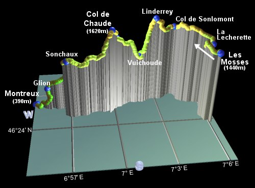
This is the fourteenth and final stage of the Alpine Pass Route, crossing from Les Mosses over the Col de Chaude to Montreux. A big event if you've been following the whole course since Sargans! The only snag is that this day is a real long one, with plenty of up, plenty of down, and nowhere convenient to stay overnight en route. So you're likely to be rather tired on arrival in Montreux, if you make all this in one day.
The scenery along the way starts off very open, strolling past the dammed Lac Hongrin and climbing steadily over Linderrey. The steep descent into the side valley and the subsequent climb back up to the Col de Chaude therefore come as something of a shock, rewarded however by the first sighting of Lac Leman from the pass. The goal in sight. From there it's an easy, although long, descent to Montreux on the lakeshore, and the end of the Alpine Pass Route. There is an opportunity to take the train on the very last bit of the descent from Glion, which would save your knees around 300m. You could also take the bus at the start, from Les Mosses to La Lécherette, knocking about an hour off the walking time.
Les Mosses has bus connections to Chateau d'Oex, from where there are train connections to Montreux and Zweisimmen. Montreux itself has many train connections in various directions, including Lausanne and Spiez.
From Zürich to Les Mosses is a long journey - either via Bern, Spiez, Zweisimmen, and Chateau d'Oex, or via Lausanne, Aigle and Le Sépey. This will take around 4 hours and CHF 42 (assuming half-price card). The return journey from Montreux back to Zürich is much simpler, taking under 3 hours and only changing in Lausanne, and costs CHF 35.
For Les Mosses see lesmosses.ch, or swiss-riviera.com.
For Montreux see swiss-riviera.com.
Hike time: | 10 hours |
Approx dist: | 28 km |
Start: | Les Mosses bus station |
Finish: | Montreux train station |
Profile: | from 1440m up to 1670m and down to 1140m, up to 1620m and down to 400m |
Rating: | easy-medium but loooooong |
Les Mosses - La Lécherette - Col de Sonlomont - Linderrey - Vuichoude - Col de Chaude - Sonchaux - Glion - Montreux
From the centre of Les Mosses, head Northwards along the main road following the yellow signposts towards La Lécherette.
Looking back Southwards, you can make out Les Diablerets, a long way behind now. Not far along this road, the yellow "Tourisme pédestre"
signposts point leftwards, to meet a track going parallel to the main road along the valley.
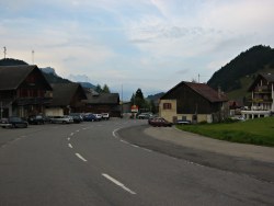
Les Mosses, with Les Diablerets in the background
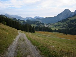
Along the valley
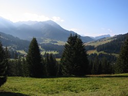
Looking back to Les Mosses
The track becomes a path, boggy and slippy in places, rising a little above the road along the valley floor. Shortly it drops down to a road, where you turn right and cross "Pont 1" to reach La Lécherette after around 50 minutes to an hour from Les Mosses. Here is a post office, a bus stop, and a helpful signpost.
Follow the signpost for Col de Sonlomont, along a narrow road behind the bus stop. This leads into an enchanted forest of
scattered chalets, with the path cutting through between the Swissness and up to a road.
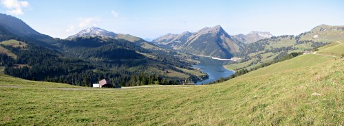
First view of Lac Hongrin and the Col de Chaude
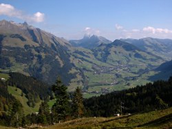
Looking East from Col Sonlomont
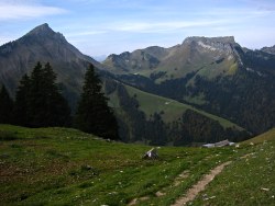
The Col de Chaude and Rochers de Naye from Linderrey
As the road winds uphill to the West, you firstly get views back to Les Mosses and the previous day's route, but as it crests the ridgetop these are replaced by a sudden panorama of the lake Hongrin. Surrounding this dammed lake are open, forested slopes, and beyond it the triangular form of the so-called Pointe d'Aveneyre. To the right of this is the famous Rochers de Naye, with its tower on top, and inbetween the two - the Col de Chaude.
Follow the level road, admiring the open views, veering right to a lookout for some scenery eastwards towards Chateau d'Oex and the somewhat Mythens-like peaks around. Shortly after this lookout you reach a signpost marked as Col de Sonlomont, around an hour from La Lécherette.
From here the road continues signposted for Linderrey and La Vuichoude, cutting back leftwards towards the lake, but still more or less level. As it starts to climb, it doubles back to the right and left, and then becomes a footpath climbing up towards the ridgetop at Linderrey.
Once at the top of Linderrey, after around 50mins from Col de Sonlomont, you begin to see where the path is going, in order to get to the
now clearly visible Col de Chaude. And the answer is, right down into the bottom of the valley below and then up the other side...
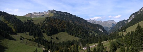
Looking back down to Vuichoude
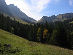
Col de Chaude
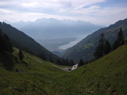
At last! Lac Leman!
Follow the path steeply downwards, looking out for the sometimes elusive red/white markings along the way. At both barn buildings, head leftwards to regain the lurking paint splashes. The Col de Chaude ahead seems to gain in height as the path zigzags down to meet a road. Turn right here, signposted Allières, and follow the road around to the bottom of this side-valley at Vuichoude (definitely not at the 1400m claimed by the signpost!).
Take the signposted path straight up between the horses towards the col, climbing steeply in zigzags through the trees to something of a false summit. The path then rounds the corner and levels off, climbing a bit more up to Chaude, with its welcome drinking spout. From here it's all roadway, curving in a wide arc to the left and gaining height steadily, finally making a beeline for the pass, to get the first views of Lac Leman from the top of the Col de Chaude, after around 2.5 hours from Linderrey.
The town of Villeneuve is visible on the shores of the lake, and looks a long way down. Montreux, our (final) destination, is around to
the right, and the signpost on the col for the first time has Montreux listed!
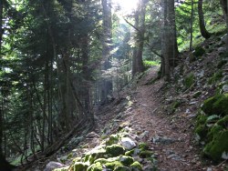
Path through the forested slopes
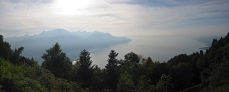
Panorama of Lac Leman from Sonchaux

Impressive buildings at Caux
Follow the signposts along the road, descending in wide hairpins towards the lake. Shortly another signpost diverts you leftwards onto a path, dropping steeply in tight zigzags to meet another road. Continue along this road, still signposted for Montreux and levelling off with views back towards the col. Ignore the tempting track leading down to the left, and stay on the road until a signposted track for Sonchaux departs to the right.
This grassy track gives panoramic views as it skirts the hillside, before becoming a narrow path climbing a loose slope. Climbing quite
steeply in some places, with some rootiness, it eventually emerges from the trees at Sonchaux after around 1h20, where there is an Auberge with an outdoor terrace
and a spectacular panorama of the lake below. It's also a popular spot for paragliders, floating overhead or taking off nearby.
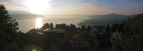
Panorama from Glion above Montreux
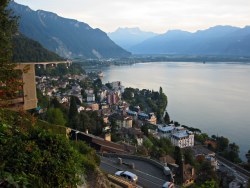
Descending into Montreux
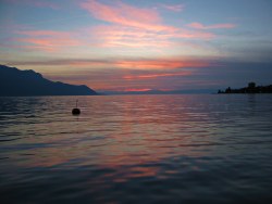
Sunset from the shore of Lac Leman. The end!
Follow the road down, still signposted Montreux, which leads to a mix of steep zigzagging paths and gently descending tracks high above the lake. This meets a road leading down to Glion, perched scenically on the slopes above Montreux, reached after around 1h10 from Sonchaux. A few minutes' walk downhill brings you to the stations at Glion, both for the funicular and the cogtrain, where you can decide to skip the remaining 40 minutes or so of the APR and rest your feet instead.
For those still standing, take the steps down from the stations, cutting down leftwards and then rightwards towards the upper end of Montreux. Use the city maps to head rightwards towards the station, between the Rue de la Gare and the Avenue des Alpes, or just head down to the lake shore for the ceremonial (and well-deserved) dipping of the feet. As the well-to-do promenade along the brightly-lit lakefront, it's an ideal time to contemplate the last 350km of hiking, and to admire the panorama sweeping round from Les Diablerets still visible far to the left, round the curve of the lake to the sunset reflected in the water.
The End.
The following are the coordinates for waypoints along this route, obtained from GPS. They can be used either in another GPS, or along with a map, to provide additional references if necessary.
                           Latitude       Longitude    Altitude(m)
       Les Mosses         N 46°23'46.9    E007°06'07.9    1438
       La Lécherette      N 46°25'11.2    E007°06'23.9    1379
       Col de Sonlomont   N 46°26'34.1    E007°04'14.6    1500
       Linderrey          N 46°26'10.3    E007°02'51.1    1669
       Vuichoude          N 46°25'59.8    E007°01'45.4    1140
       Chaude             N 46°25'38.1    E007°00'10.1    1475
       Col de Chaude      N 46°25'18.7    E006°59'50.5    1621
       Sonchaux           N 46°24'56.3    E006°56'54.6    1260
       Glion              N 46°25'56.5    E006°55'30.9     708
       Glion station      N 46°25'54.6    E006°55'26.2     699
       Montreux station   N 46°26'10.1    E006°54'36.2     405
       Lake               N 46°26'11.9    E006°54'27.3     390
For local information, see lesmosses.ch and montreux.ch, including a good city map of Montreux.