

 |
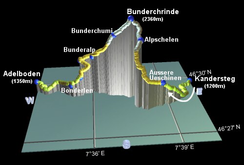
This is the tenth stage of the Alpine Pass Route, crossing from Kandersteg over the Bunderchrinde to Adelboden. Our previous stage over the Hohtürli made an overnight stop at the Oeschinensee, so the extra hour's descent down to Kandersteg will be tacked onto this Bunderchrinde crossing to make rather a long day. The chairlift down from Oeschinensee to Kandersteg can reduce some of the descent, but here on the Bunderchrinde the only assistance you can call on are the buses or gondolas at the very end lifting you up to Adelboden, which isn't far at all by foot.
The scenery here is similar to that on the Hohtürli, and although it's quite a bit lower, at only 2400m, it still has the dramatic rocky cliffs and the loose scree to make things interesting. And a bit tricky, perhaps, in places. The large amount of up and down makes this a tiring day.
Kandersteg is a major station on the rail line from Spiez southwards to Brig, and provides an important link through the Lötschberg tunnel to Wallis. Adelboden has a bus station with links down the scenic valley to Frutigen, which lies on the Kandertal line between Kandersteg and Spiez.
From Zürich, some of the trains to Kandersteg are direct, and some require changes in Bern and/or Spiez, but they all take round about 3 hours and CHF 35. Coming back from Adelboden, you need a bus to Frutigen and the train from there through Spiez and Bern - the trip to Zürich takes around 3 hours and CHF 36 (all prices assuming half-price card).
For Kandersteg, see kandersteg.ch and for Adelboden see adelboden.ch. Unfortunately there's nowhere obvious to overnight on the way, if you wanted to break it up.
Kandersteg - Äusser Ueschinen - Alpschelen - Bunderchrinde - Bunderchumi - Bunderalp - Bonderlen - Adelboden
Hike time: | 7 hours |
Approx dist: | 16 km |
Start: | Kandersteg station |
Finish: | Adelboden bus station |
Profile: | from 1200m up to 2400m and down to 1350m |
Rating: | medium-tricky |
From Kandersteg station, the route takes a course away from the Oeschinensee and to the right of the ugly power lines trailing up to Sunbüel and the Gemmi Pass. The signpost at the station leads towards either Bonderkrinde or Bunderchrinde along a road alongside the railway tracks. You're then led under a bridge to the broad footpath alongside the swift-flowing, greyish river. Not far along here you pass a paragliding landing-place by the base of the Allmenalp cable car. This cable car offers a 500m lift, and although it doesn't quite go where we want to go, some people might find the prospect of a scenic traverse to Äusser Ueschinen from the upper cable car station preferable to the more direct climb on foot.
Continuing along the river, you shortly come to the Pfadfinderzentrum, an international scout camp, which finally explains why there were so many woggles in Kandersteg centre.
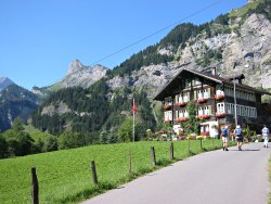
Road leaving Kandersteg

Riverside path outside Kandersteg
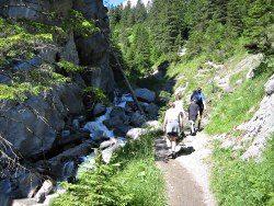
Path climbing alongside stream

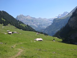
Panorama by Äusser Ueschinen
Continuing upstream, the signposted path now starts to climb, before meeting and following a road uphill. Shortly the path again leaves the road and climbs up a narrow gorge carved by a gushing side-stream. With occasional steps, some of this ascent is fairly steep and it is with some relief that you emerge from the trees in the high valley of Äusser Ueschinen.
Here you're presented with a quiet, U-shaped valley, a gentle grassy path, and a massive, looming, craggy, impossible wall of rocks directly ahead. Surely our path doesn't go up there?
Looking back towards the Oeschinensee

Path climbing high above the valley
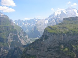
Looking across at the Gasterntal
The path leads gently across the grass, passing below the basic restaurant and alp (known as Usser Ueschinen) with its many home-made specialties. With the path then curving round to the left, it seems as though we're heading up the gentle valley after all, and not straight up the cliff, but beware- this is a trick!, as the signposts shortly double back to the right for some steep switchbacks.
One thing about this steep climbing though, there's plenty of opportunity to look back and see the scenery unfold. The bowl of the Oeschinensee comes slowly into view, and the jagged icy peaks above the Gemmi pass rise majestically above the ridge as you climb. The Gasterntal, another textbook glacial valley, slides serenely past, far below.
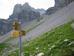
Pass finally in sight

Panoramic view from the Bunderchrinde towards Adelboden
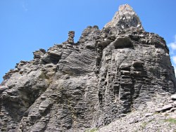
Rocks by the pass
Eventually you reach Aschelen, with a small herd of cows and a small hut offering drinks. The path heads more gently upwards from here, heading apparently for a grassy dip on the skyline which looks tantalisingly (and somewhat surprisingly) close by. But beware. Here is another trick! - the signpost doubles you back to the left to reveal the forbidding notch in the cliffs, lurking menacingly beyond the scree. That is the pass.
The rocks towering above the pass have a curious, stratified appearance which has obviously given rise to the huge amounts of shale around the top. One last push over the loose stones and the summit is reached - with spectacular views on both sides. Looking back, you can clearly see the Oeschinensee, the Hohtürli, the Gasterntal and the ridges above Sunbüel; looking forward shows cliffs and a scree bowl, leading down to Adelboden deep in the valley. Beyond Adelboden is another sharply-defined ridge but the next pass on this route, the Hahnenmoospass, is for the moment out of sight, round the corner to the left.
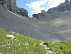
View back up to the notch-like pass
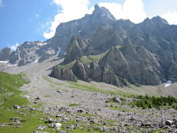
Contorted rock formations
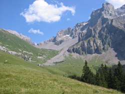
Another view back up to the pass
Having sufficiently rested at the top, take the steep rocky switchbacks down the scree-covered slope, returning shortly to friendlier grassiness. The cliffs up to the left have eroded into organic, conical forms, and have shed sizeable boulders onto the hillside in the process.
Descending through the grassy pastures, you reach Bunderalp with its restaurant and touristenlager, and are offered two signposted alternatives down to Adelboden. The track leading straight ahead towards Bunderlen keeps the views for slightly longer and offers a perfect picnic spot at "Ufem Stutz" with views up and down the Adelboden valley. And you can still see the notch of the Bunderchrinde clearly on the contorted skyline behind.

Panorama of the Adelboden valley from Ufem Stutz

Engstligenalp from Adelboden
From here, as they say, it's all downhill, with a long descent on road and on paths shortcutting the road down through Bunderweiden to Bunderlen. Up to the left is the valley of Engstligenalp, (not to be confused with Engstlenalp, seen earlier on this route!), a graceful bowl-shaped hanging valley. Eventually the road emerges to cross the river at a sawmill. And here's a surprise - it's not all downhill after all. Adelboden is perched up a good 100m above this stream, so there's a little bit more climbing to do before the day is out.
The signposts lead up through a tangle of residential roads to reach the main street of Adelboden, not far from the cable car station. The bus station is just to the right of the main street, with an obvious "bus station" sign where the entrance isn't, and a not-too-obvious sign round the right-hand side where the entrance is.
For the next stage on the Alpine Pass Route, see Adelboden to Lenk.
The following are the coordinates for waypoints along this route, obtained from GPS. They can be used either in another GPS, or along with a map, to provide additional references if necessary.
                           Latitude       Longitude    Altitude(m)
       Kandersteg         N 46°29'42.8    E007°40'18.2    1207
       Pfadfinder         N 46°29'00.6    E007°39'49.8    1185
       Äusser Ueschinen   N 46°28'22.2    E007°38'42.3    1548
       Alpschelen         N 46°28'45.5    E007°37'55.2    2094
       Bunderchrinde      N 46°28'57.0    E007°37'34.1    2364
       Bunderchumi        N 46°29'07.0    E007°36'55.4    2120
       Bunderalp          N 46°29'25.2    E007°36'02.8    1755
       Ufem Stutz         N 46°29'31.7    E007°35'31.4    1680
       Bunderweiden       N 46°29'12.6    E007°35'29.7    1480
       Bonderlen          N 46°29'11.4    E007°35'06.5    1360
       Adelboden Bus      N 46°29'36.2    E007°33'35.4    1348
For local information, see kandersteg.ch and adelboden.ch, including a map of the Frutigen area.