

Hike time: | 2.5 to 3 hours |
Approx dist: | 7 km |
Start: | Car park at end of road |
Finish: | Car park at end of road |
Profile: | from 85m up to 180m, and back again |
Rating: | Mostly easy paths but steep and slippy ascent to summit |
This walk explores the very eastern tip of the island, winding around the narrowing peninsula to a remote peak just before the last lighthouse. Along the way there are sweeping Atlantic panoramas, colourful cliffs, bracing sea air and swooping sea birds.
It's quite popular to do this short walk in the evening, as you get the remote atmosphere with the setting sun - but make sure you don't leave it too late as it's not the best place to get stuck in the dark!
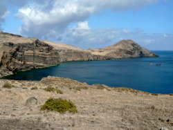 View along the peninsula 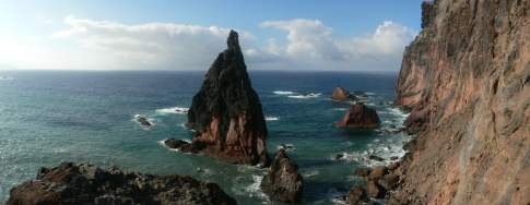 Panorama from the lookout point over the ocean 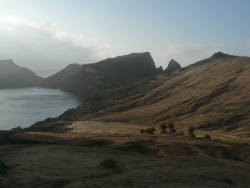 Evening sun on the rugged coastline 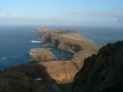 View from the final peak towards the lighthouse |
Just drive your hire car as far east as you can go. At the end of the road, there's a roundabout where you can turn round and plenty of car park spaces. The walk begins and ends at this remote roundabout.
This kmz file (4 kb) contains waypoints from this São Lourenço hike and shows the path as a red line along the peninsula. Simply open it in Google Earth (File -> Open) and you'll see the route in full. Press the "Play Tour" button below the listed waypoints and you can fly a tour along the hike in 3d.
car park - São Lourenço - car park
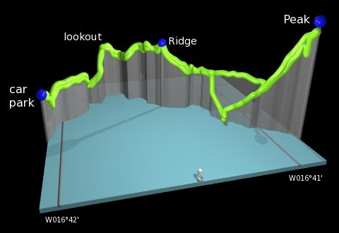 |
From the car park, head past the roundabout and take the track leading directly ahead. When the track forks directly after the wooden barrier, take the right fork and head down wooden steps to the north. The wooden protective walkway curves rightwards and climbs back up again with more steps. Looking now rightwards, we see our goal for this hike, with the rounded peak of our summit, the lighthouse further out, and an interesting arch carved out of the cliff by the relentless waves. On a clear day you can even see the nearby islands of Ilhas Desertas.
Follow the path straight ahead until it reaches a crossroads. Here, the left-hand path leads a short distance to a marvellous lookout point over the sea to the North, and the right-hand path leads down to a small cove with a secluded (but overlooked) beach. Our route (after checking out the lookout point of course) continues straight ahead eastwards, climbing to a narrow ridgetop stretch with some steep drops on both sides of the path. Everything is secured with handrails but it's nice to have footwear with decent grip at this point!
After the ridge, the path reaches a plateau with a clearly visible building ahead. This is the Casa da Sardinha and is a park ranger station for observing the wildlife and maintaining the paths. When our path forks, one option bears left and follows a flat route above the Casa, whereas the right-hand route drops down sets of steps towards the sea. We'll take the flatter way to the left, heading southeast on an easy path round the left-hand side of the building and joining the other route just before the ascent starts.
The final ascent gets quite slippy as the number of footsteps wears down and crumbles the volcanic soil into a fine dust. The path breaks down into several worn paths working their way slowly up the hill. When you think you've reached the top, it's the first of two such peaks and the second one, just a little bit further on, is a tiny bit higher and gives a better view out to the end of the peninsula. From there you get a wonderful panorama including the lonely lighthouse just beyond a narrow water channel, the colourful cliffs, the huge ocean, and the Madeiran coastline round to the Funchal airport and beyond. There's a real feeling about being at the furthermost end of the island.
On the way back we took the left fork by the Casa to take the alternative route back via the coast - steps lead down all the way to a small landing stage by the water if you really want, and then back up another set of steps through a picnic area to rejoin the outbound route.
The final stretch is just retracing the outbound route over the ridgetop and past the lookout point and back to the car park.
The following are the coordinates for waypoints along this route, obtained from GPS. They can be used either in another
GPS, or along with a map, to provide additional references if necessary.
                           Latitude       Longitude    Altitude(m)
       Car park           N 32°44'35.5    W016°42'04.1      84
       Lookout            N 32°44'56.3    W016°41'51.7      53
       Ridge              N 32°44'47.9    W016°41'25.4     127
       Casa               N 32°44'30.9    W016°41'00.0      58
       End point          N 32°44'20.7    W016°40'51.7     183
There's a brief description of this walk and several colourful photos at sanmarko.nl.