
|
This Ghandruk trek starts from the same place as the Jomsom trek but makes a shorter, lower loop back towards Pokhara. It can be done as a self-guided trek, but is often done as an organised, all-included trip using higher-standard accommodation and porters.
As described here, the trek starts at Nayapul (new bridge) on the main road not far from Birethanti. From Pokhara this is around 30km by bus or taxi, and easily arranged. It's a popular start point for several treks so it's well known. The end of the route is at Phedi which is also a popular access point from the main road, with either bus or taxi connections back to Pokhara.
This kmz file (1 kb) contains waypoints from the Ghandruk trek and shows the main waypoints along the route. Simply open it in Google Earth (File -> Open) and you'll see the route in full. Press the "Play Tour" button below the listed waypoints and you can fly a tour along the route.
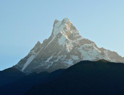
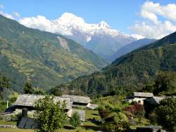
 Fishtail mountain on the way to Ghandruk  View down the valley from near Ghandruk |
Birethanti - Ghandruk - Birethanti - Majgaun - Dhampus - Phedi
The start of the trek is at Nayapul, easily reached from Pokhara. From there it's a short and easy walk to Birethanti, and on to the first night's accommodation at the Sanctuary Lodge just above the village. An easy start!
The next stage of the trek is one of the longest, heading north up the Modi valley to Ghandruk, with spectacular views of the Annapurna range. This is the highest and northernmost point of the journey.
The third walking day leads back down the valley but on the other side, through Kimche and back to Birethanti. It's all downhill but some of it fairly steep.
The next section is a short one, uphill to the east to the village of Majgaun.
The final day continues eastwards up to Dhampus, and then drops down to the valley floor at Phedi and the end of the tour.
The following are approximate coordinates for waypoints along this route, obtained from maps and internet resources. They can be used either in a GPS receiver, or along with a map, to provide additional references if necessary.
                            Latitude       Longitude    Altitude(m)
        Nayapul/Birethanti N 28°17'59"     E083°46'14"     1060
        Sanctuary Lodge    N 28°19'39"     E083°47'45"     1120
        Ghandruk           N 28°22'40"     E083°48'27"     2020
        Majgaun            N 28°19'18"     E083°48'29"     1450
        Dhampus            N 28°18'06"     E083°51'45"     1650
        Phedi              N 28°17'27"     E083°52'43"     1150
While we can't recommend any specific companies for this trek, there is some useful information about the lodges mentioned here at Audley Travel's page and Saga's tours include a description of their itinerary (see "Trekking in Nepal").