

Assuming that you don't want to spend a lot of money on additional maps for your GPS unit, and assuming you have the appropriate hardware (see the introduction), you might want to consider downloading maps from the internet.
This page shows you how you can use the free and legal map resources from openstreetmap with a Garmin GPS unit to add extra map details for free.
In order to load a map into the receiver, you'll need to get a file in the "IMG" format. These files can be generated from the openstreetmap data but fortunately there are already many map files already created and chances are there will be one to match your required area. Start at gpsmapsearch.com and use the map interface to find an img file covering the area you want. Download this file and save it to your computer. The file may be zipped into an img.gz file, in which case simply extract the file from inside the zip to get an img file.
Another good source of specially-prepared img files is cloudmade.com - there are lots of files available for many different countries and areas so just pick one covering the area you want. Then unzip the file to get the img file.
Connect the GPS receiver via the cable to the computer's USB port and switch it on. Now, from the main menu on the receiver, choose "Setup" followed by "Interface" and click the button "USB Mass Storage". This changes the mode of the receiver to act as a mass storage device and offers the card storage as a drive to the computer.
Open this new drive, and if necessary create a new directory in the root called "garmin". Navigate into this directory.
Now copy the downloaded img file into the directory, and name it "gmapsupp.img" - this filename is important as it's the only one recognised by the receiver. If you already have a file there with this name, you'll need to delete it or rename it in order to load the new map.
Now disconnect ("safely remove") the drive from the computer, and the receiver should restart. In the start up screen you may notice a copyright notice for openstreetmap.org, indicating that the unit has found and loaded the img file properly. You can now unplug the cable from the receiver and the computer if you want.
Now, simply navigate to the part of the world covered by the map, and you should notice lots of extra detail. Openstreetmap hasn't got uniform coverage, so big cities are likely to have more and better detail than less-populated areas. But it's often surprising just how much information is available for free.
As an example, take the island of Tenerife in the Atlantic ocean, and view using the factory-installed basemap. Here we see successive zooms showing the level of detail:
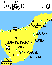 Island view using basemap |
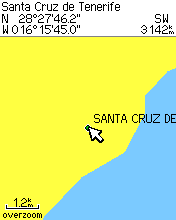 Zoomed view using basemap |
 300m scale view using basemap |
With the standard basemap the island's coastline is given, and a few of the major towns, but the detail is as expected extremely low.
Zooming to the 1.2km scale, just a single town name is given, with no roads or other information.
Zooming further to the 300m scale, even for this large city, gives no detail at all. That might be ok for some purposes, but it would be much more useful if the map contained more information.
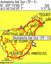 Island view using osm map |
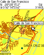 Zoomed view using osm map |
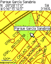 300m scale view using osm map |
The first thing noticed about the map is the sudden lack of sea - this is a slightly annoying outcome of the image file generation process. But we can also see that the detail is hugely improved - we have highways, more named towns, and minor roads, many of which are already named.
Zooming in further, we can see small streams, green areas, and even tiny roads with attached names. As always the names take a little time when "hovering" over them to become visible, and not all roads or features have names attached.
Zooming still further, we can see even more detail including named parks, and footpaths, with information right down to the 120m scale. This makes the GPS even more useful as an exploration device.
As another example, let's see maps of two German towns, Stuttgart and Ulm, and compare the European basemap with a corresponding image file from openstreetmap.
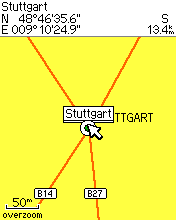 Stuttgart centre using basemap |
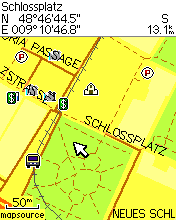 Stuttgart centre using osm map |
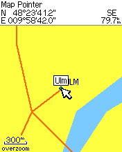 Ulm centre using basemap |
 Ulm centre using osm map |
The new maps show much more useful detail including parks, train stations, churches, footpaths and cashpoints. There are even bars, restaurants, cinemas and picnic spots entered, making it a useful tool not only in strange cities but also in familiar ones.
Using this method, only one map file can be loaded into the receiver at a time. If you want to use multiple maps, you need to look at combining maps so you can create a file containing multiple maps.